IDEA: Isabella d’Este Archive is redesigned, and back online. IDEA includes manuscript visualizations, videos, and a virtual model of Isabella d’Este’s famous studiolo as well as a Zotero bibliography of materials relating to Isabella and the Italian Renaissance. See IDEA’s News link for book announcements and other relevant notices.
This resource is aimed at helping the humanities community collect data about the impact of programs such as professional development seminars, public humanities projects, and programs for students that prepare them for college and help them imagine humanities careers. These surveys are designed to support the humanities community in articulating the impact of its work and making the case for the resources to support it.
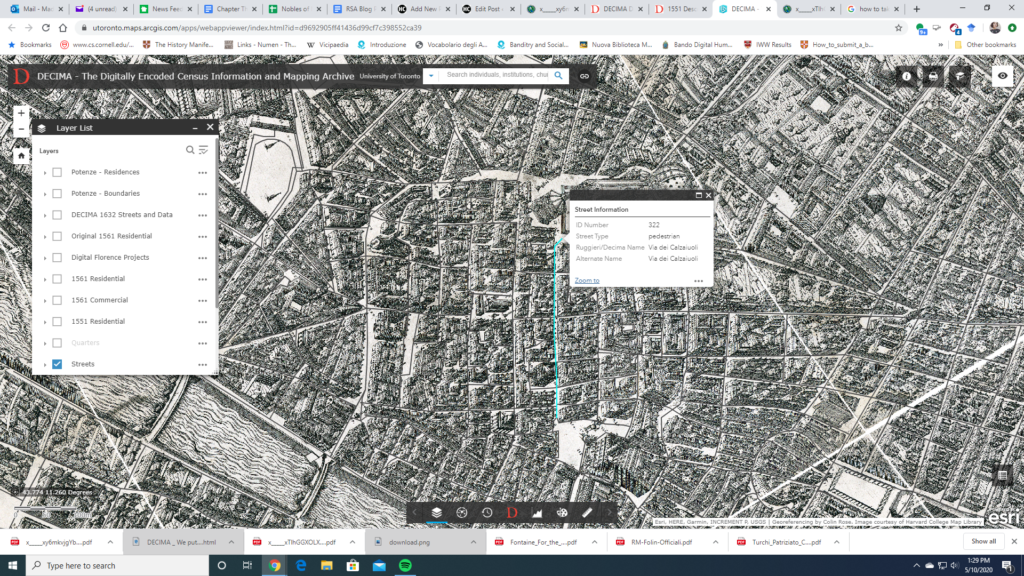
The historical mapping project DECIMA uses an ArcGIS framework to allow for spatial analysis of social and economic data from early modern Florence. Using Florentine census data from the sixteenth and seventeenth centuries and Stefano Buonsignori’s 1584 map of Florence, the DECIMA project permits the user to explore historical Florence in unique ways. The mapping tool facilitates research by allowing users to query the database, generate charts, bookmark places on the map, as well as print and export results.
A useful glossary and typology for the data classification in the database is provided to aid with research. Several other useful features of the website include a how-to guide and case studies of pedagogical as well as research usage of the tool. An accompanying volume has been published with articles highlighting the development of the tool and case studies showing how scholars have used it in their work. A bibliography on the website directs the user to further resources.
The project provides a model for a large scale historical GIS project and shows the exciting potential for this method of research. In particular, the interface is user-friendly for both beginners and specialized researchers unfamiliar with GIS or early modern Florence. Several features of the website stand out: the data query tool in particular makes it easy to apply and compare different types of data.
A search function also allows for specialized queries of individuals, institutions, churches, etc. The zoom tool also allows the user to look at a bird-eye overview as well as drill down to the street level. One can map, for example, the location of prostitutes and their living quarters by street. The Buonsignori map opens a fascinating window into the historical landscape and combined with the census data, DECIMA takes advantages of the affordances of GIS to paint a rich picture of early modern Florence.