Medici Archive Project

The Medici Archive Project began as an electronic database of letters and other documents in the Medici Granducal Archival Collection and has evolved into a research institute supporting digital projects and offering seminars and fellowships.

MAP’s online collection, BIA provides access to an unparalleled range of digitized early modern material. The material comprises over 24,000 transcribed documentary records, 18,000 biographical entries, 87,000 geographical and topographical tags, and over 300,000 digitized images from 292 volumes of the Mediceo del Principato. Aside from providing a faster and more user-friendly interface for document entry, BIA has enabled scholars from all over the world, not only to view digitized images of archival documents, but also to enter transcriptions, provide scholarly feedback, and exchange comments in designated forums, all within BIA’s academic community of over 2400 international scholars, students, and enthusiasts who daily engage with one another, with the ever-increasing number of uploaded digitized documents, and with the staff and fellows of the Medici Archive Project.

Hidden Florence

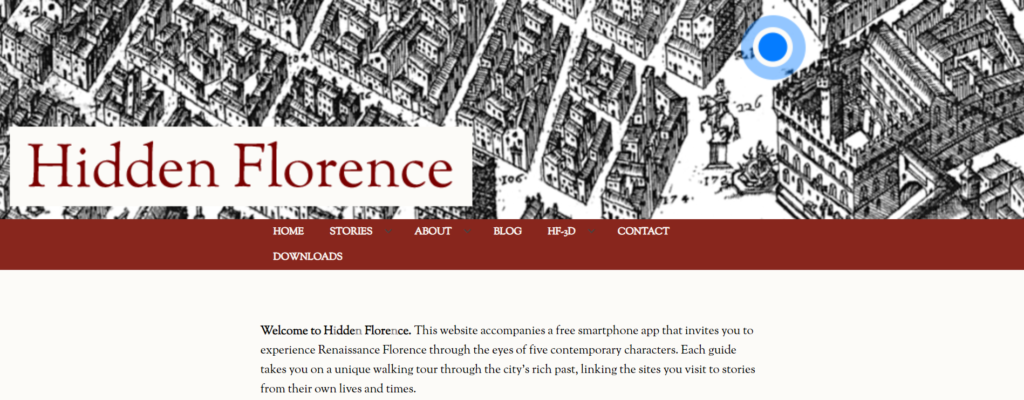
Website and free geolocated walking tour audio app for iPhone and Android keyed to the social and cultural history of Florence designed for wide user base and age group. With the app, the user navigates Florence toggling between a modern and a superbly detailed sixteenth-century map. On the website, users can read about each guide and the places they go (‘Stories’), discover more about the project team (‘About’), and find out how the characters were designed (‘Blog’).

Guide characters are:

Cosimo: Master of Florence, 1459
First citizen or godfather? Cosimo de’ Medici takes you through the city he’s spent a lifetime trying to make his own.

Giovanni: Neighbourhood World/People and Politics, 1490
Discover local worlds and get a different perspective on the heart of Florence as Giovanni, a wool worker, walks you through a day in his life.

Niccolosa: Saints and Sinners, 1492
Explore Florence’s sacred foundations with Niccolosa Alessandri as the city faces an uncertain future after the death of Lorenzo the Magnificent.

Marietta: City of Women, 1561
Join Marietta as she traces her journey from the city orphanage to life as a silk weaver.

Ercole: Crime and Punishment, 1566
From the torture chamber to the gallows, Ercole shows you how justice was done in the Renaissance city.

The app and website have been written by an international team of researchers and is a collaboration between the universities of Exeter, Cambridge and Toronto, with project partners at the National Gallery (London), Polo Museale della Toscana and Firenze Patrimonio Mondiale (UNESCO).

DECIMA

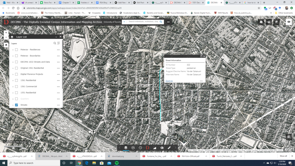
The historical mapping project DECIMA uses an ArcGIS framework to allow for spatial analysis of social and economic data from early modern Florence. Using Florentine census data from the sixteenth and seventeenth centuries and Stefano Buonsignori’s 1584 map of Florence, the DECIMA project permits the user to explore historical Florence in unique ways. The mapping tool facilitates research by allowing users to query the database, generate charts, bookmark places on the map, as well as print and export results.

A useful glossary and typology for the data classification in the database is provided to aid with research. Several other useful features of the website include a how-to guide and case studies of pedagogical as well as research usage of the tool. An accompanying volume has been published with articles highlighting the development of the tool and case studies showing how scholars have used it in their work. A bibliography on the website directs the user to further resources.

The project provides a model for a large scale historical GIS project and shows the exciting potential for this method of research. In particular, the interface is user-friendly for both beginners and specialized researchers unfamiliar with GIS or early modern Florence. Several features of the website stand out: the data query tool in particular makes it easy to apply and compare different types of data.

A search function also allows for specialized queries of individuals, institutions, churches, etc. The zoom tool also allows the user to look at a bird-eye overview as well as drill down to the street level. One can map, for example, the location of prostitutes and their living quarters by street. The Buonsignori map opens a fascinating window into the historical landscape and combined with the census data, DECIMA takes advantages of the affordances of GIS to paint a rich picture of early modern Florence.