This ongoing work was conceived as an adjunct to the textbook The Origins of Early Modern Italy, 1550–1800 in order to place at the disposal of students and scholars the complete span of scholarship on Italy published in English and French. The material encompasses all aspects of political, social, economic, and cultural life in the broader Italy, including Corsica and Malta, and the mutual influence of Italy and other European countries. It contains an introduction and historiographical overview, supported by a statistical breakdown of types of studies over the last 150 years.
The Drawings of the Florentine Painters, a robust digital resource based on Berenson’s publication of the same name, allows users to search for nearly 4000 drawings by artist, title (i.e. subject, in English or Italian), location, and technique. Each entry includes key information from all three editions of Berenson’s text (1903, 1938 in English; 1961, in Italian), as well as the current location, an image of the catalog page, and plates included in 1903; most entries also have links to museum webpages, including images.
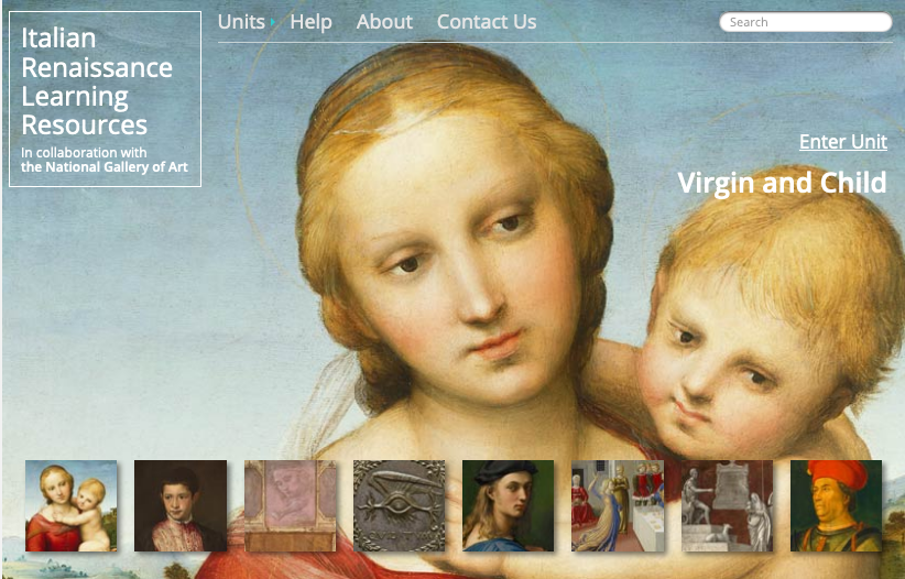
A project of the National Gallery of Art, this website features eight teaching units that explores a theme in Italian Renaissance Art including “Presentation of Self,” “Pictuing Family and Friends,” and “Time and Narrative.” Includes thematic essays, 300 plus images, a glossary, and primary source texts.
The Jewish History Program has recently launched the Ghetto Mapping Project, a research project whose aim is to reconstruct the economic and social fabric of the Florentine ghetto, the third oldest ghetto in the world. Grand Duke Cosimo I established the ghetto of Florence in 1570, near the area of Mercato Vecchio, in the very center of the Tuscan capital. While officially erected to gather all the Jews of the Grand Duchy under the aegis of Counter-Reformational tenets, the ghetto of Florence was in fact a product of a very well planned, private real-estate investment of the Medici family.
The Ghetto Mapping Project consists of three main parts:
1. The virtual reconstruction of all the spaces in ghetto, from its foundation in 1570 to its demolition in 1888. This will be executed by elaborating and combining together into a 3D model, architectural information gleaned from detailed and comparative surveys of the ghetto drafted for the Medici. In addition to this data, this project will also incorporate archival documents, paintings, watercolors, and archaeological surveys from other Florentine collections. The ghetto is probably the most documented neighborhood of Florence. As such, this study will provide invaluable information to scholars working on any field related to the humanities. Moreover, as one of the first examples of a planned, semi-public housing project in modern Europe, this digital initiative will also be of primary importance to architects, urban planners, and sociologists.
2. Ghetto economy. The ghetto was a Medici property. Therefore, the entire complex, its inhabitants, and anything housed within its premises was carefully described and recorded by Medici functionaries. From an archival and documentary standpoint, the ghetto was one of the most heavily controlled areas of the city. Despite the incredible wealth of available archival sources, the ghetto has ever been studied with specific economic-financial perspective. Medici administration produced, over a period of circa two centuries, hundreds of volumes pertaining to the ghetto, which provide us with an unprecedented quantity of economic and financial information.
3. Demography and history. Along with architectural and economic information, Medici documents offer one of the richest, most exhaustive, and chronologically most extended set of Jewish demographic data. This corpus of archival material will allow us not only to determine precisely how many Jews lived in the ghetto in any specific period of its history, but also to trace family ties and outline genealogical trees.
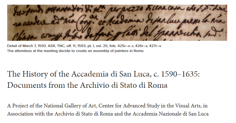
A project of the Center for Advanced Study of the Visual Arts at the National Gallery of Art, Washington, DC, the searchable database includes a complete transcription of every extant notarial record of the period from the Archivio di Stato di Roma identified by the project team, as well as a digital images of the original documents. The site also features artist bibliographies and a database of images associated with the early history of the Accademia di San Luca and its members during the sixteenth and seventeenth centuries.
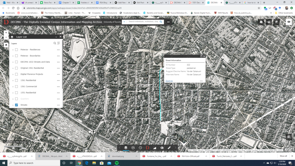
The historical mapping project DECIMA uses an ArcGIS framework to allow for spatial analysis of social and economic data from early modern Florence. Using Florentine census data from the sixteenth and seventeenth centuries and Stefano Buonsignori’s 1584 map of Florence, the DECIMA project permits the user to explore historical Florence in unique ways. The mapping tool facilitates research by allowing users to query the database, generate charts, bookmark places on the map, as well as print and export results.
A useful glossary and typology for the data classification in the database is provided to aid with research. Several other useful features of the website include a how-to guide and case studies of pedagogical as well as research usage of the tool. An accompanying volume has been published with articles highlighting the development of the tool and case studies showing how scholars have used it in their work. A bibliography on the website directs the user to further resources.
The project provides a model for a large scale historical GIS project and shows the exciting potential for this method of research. In particular, the interface is user-friendly for both beginners and specialized researchers unfamiliar with GIS or early modern Florence. Several features of the website stand out: the data query tool in particular makes it easy to apply and compare different types of data.
A search function also allows for specialized queries of individuals, institutions, churches, etc. The zoom tool also allows the user to look at a bird-eye overview as well as drill down to the street level. One can map, for example, the location of prostitutes and their living quarters by street. The Buonsignori map opens a fascinating window into the historical landscape and combined with the census data, DECIMA takes advantages of the affordances of GIS to paint a rich picture of early modern Florence.