Dubrovnik: Civitas et Acta Consiliorum – Visualizing Development of the Late Medieval Urban Fabric

https://ducac.ipu.hr/project/

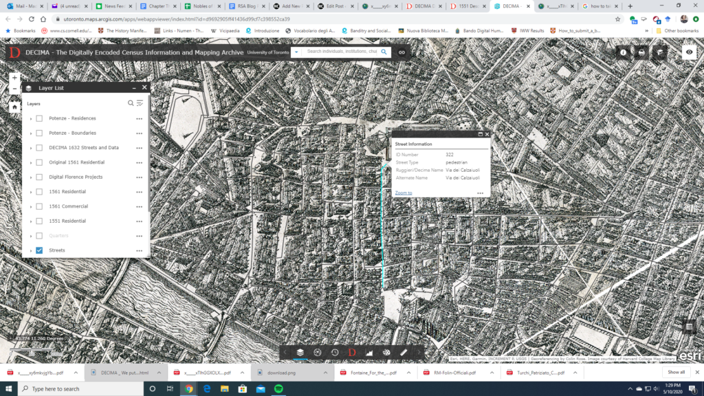
The DUCAC project – “Dubrovnik Civitas et Acta Consiliorum. Visualizing Development of the Late Medieval Urban Fabric” studied the relationships between the space-policy of the Dubrovnik government, its implementation, and the real changes in the urban fabric. The archival investigation examined the deliberations of the city councils (the Major, the Minor, and the Senate) from the first half of the 15th century. These deliberations are written down in 35 volumes. They have 7,972 folia, i.e. 15,944 pages, written predominantly in Latin. Focusing on topics of interest to art historians, the deliberations revealing information on the urban fabric – more precisely information about its construction, use, maintenance, as well as the management of these processes, were transcribed. The number of the total counted transcribed deliberations is 3341. They are offered in a map searchable database where deliberations can be found in accordance with the location of the building or the space they record. Only some of these newly discovered documents were thoroughly studied so far, comparing the data from the deliberations with the existing urban tissue and previously collected architectural, photographic, and archival documentation. These studies resulted in 2D or 3D visualizations, and are duly listed on the project web page. The database still offers abundant data for further in-depth research of Dubrovnik urban history.

Cives Veneciarum

Cives Veneciarum

This is a database of some 3,600 citizenship privileges conferred on some 4,000 immigrants to Venice, from the twelfth century (one case) to the year 1500. The search program is easy to use; an introduction to the database is Reinhold C. Mueller’s Immigrazione e cittadinanza nella Venezia medievale, Deputazione di Storia Patria per le Venezie 1, Rome: Viella, 2010.

DECIMA

The historical mapping project DECIMA uses an ArcGIS framework to allow for spatial analysis of social and economic data from early modern Florence. Using Florentine census data from the sixteenth and seventeenth centuries and Stefano Buonsignori’s 1584 map of Florence, the DECIMA project permits the user to explore historical Florence in unique ways. The mapping tool facilitates research by allowing users to query the database, generate charts, bookmark places on the map, as well as print and export results.

A useful glossary and typology for the data classification in the database is provided to aid with research. Several other useful features of the website include a how-to guide and case studies of pedagogical as well as research usage of the tool. An accompanying volume has been published with articles highlighting the development of the tool and case studies showing how scholars have used it in their work. A bibliography on the website directs the user to further resources.

The project provides a model for a large scale historical GIS project and shows the exciting potential for this method of research. In particular, the interface is user-friendly for both beginners and specialized researchers unfamiliar with GIS or early modern Florence. Several features of the website stand out: the data query tool in particular makes it easy to apply and compare different types of data.

A search function also allows for specialized queries of individuals, institutions, churches, etc. The zoom tool also allows the user to look at a bird-eye overview as well as drill down to the street level. One can map, for example, the location of prostitutes and their living quarters by street. The Buonsignori map opens a fascinating window into the historical landscape and combined with the census data, DECIMA takes advantages of the affordances of GIS to paint a rich picture of early modern Florence.